

")
Track History For Chantal
(Data: NOAA/NHC)
Tropical Storm Chantal made landfall in South Carolina and triggered serious flooding in central North Carolina where it also generated a few tornadoes in early July 2025.
Track History
Tropical Depression Three formed off the Southeast coast late in the afternoon on July 4. It then strengthened into Tropical Storm Chantal the next morning.
Chantal made landfall near Litchfield, South Carolina, early July 6 with estimated maximum sustained winds of 60 mph. It weakened to a tropical depression as it spread inland over the Carolinas and then dissipated on the morning of July 7 near eastern Virginia and southern Maryland.
Weather in your inbox
Impacts
Wind gusts over 50 mph were clocked at landfall along the South Carolina coast, including 56 mph at Springmaid Pier and 54 mph in Myrtle Beach.
On the evening of July 6, Chantal produced extreme rainfall across a narrow strip of central North Carolina between Raleigh and Greensboro, including parts of the Chapel Hill and Durham areas. Rainfall totals in this region ranged from 4 to 12 inches.
The flooding from the heavy rain inundated some homes, multiple vehicles and prompted dozens of water rescues.
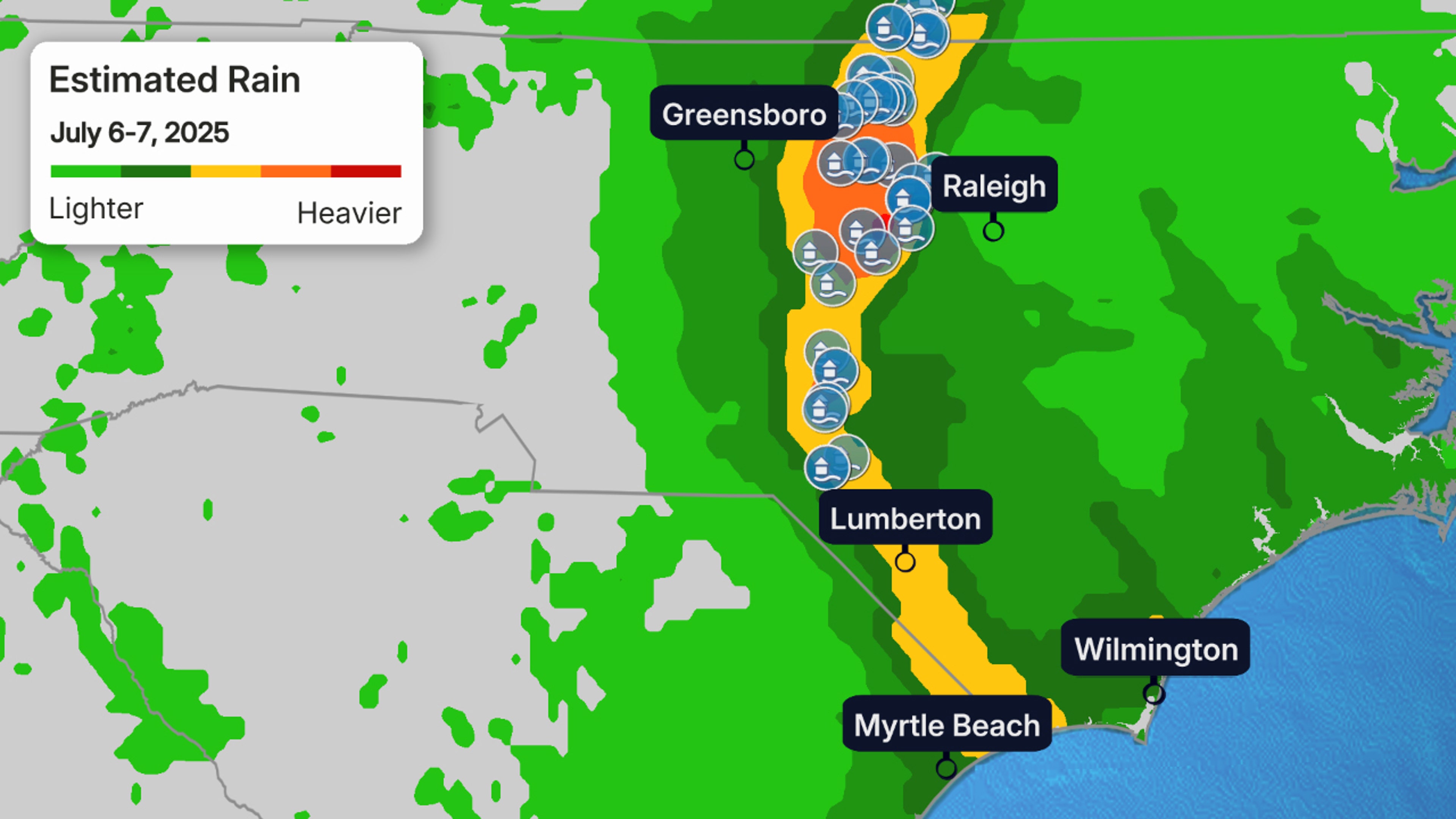
Estimated Rainfall And Flood Reports
(The contours shows where the heaviest rain fell. The blue dots are flood reports submitted to the National Weather Service.)
Moderate to major flooding was observed at some river and creek gauges in the region. That includes one gauge on the Haw River that hit a crest just short of a record set by Hurricane Fran in 1996.
About 120 roads were closed across the state at one point early July 7. An 83-year-old woman was killed when floodwaters swept away her vehicle in Chatham County, the Associated Press reported.
Chantal also produced a handful of brief tornadoes in North Carolina. Four of them in central North Carolina were rated EF1 and another one near Wilmington was rated EF0.
